APRS stands for "Automatic Position Reporting System" - a technology originally developed by Amateur Radio Operators (HAMs). Basically, it is a system that combines GPS positioning, HAM radio, and Internet technology. If you would like to know more about the system itself, here is a good Resource Site. What I'll be describing here is the simplest implementation of APRS - a position reporting beacon.
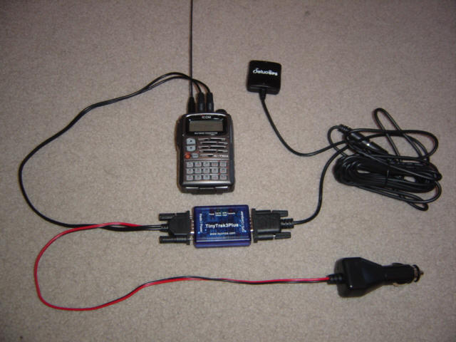
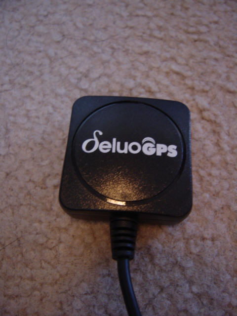
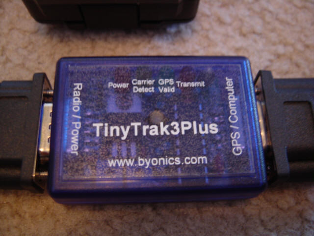
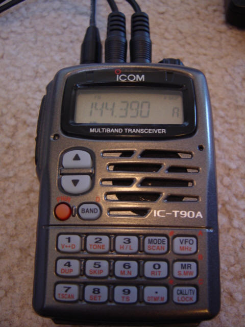
A beacon system consists of three parts - a GPS receiver, a Terminal Node Controller (TNC) and a transmitter. The GPS receiver is obviously used to calculate the unit's exact location. I'm using an all-in-one device that has the antenna, position calculation chip, and data interface all contained in a 1.5"x1.5"x.5" unit. The GPS sends it's data to aTinyTrack3 controller that basically acts as both a modem and radio controller. It is programmed to send a short burst of digital information called a "packet" every few minutes. This packet is sent to the radio transmitter on a certain frequency that is picked up by numerous ground stations and internet gateways. The digital position information is then shared between several servers on the internet and/or used by APRS receivers, overlaid on a detailed map, and graphically presented to the user - anywhere in the world. Kewl, huh!?! My Amateur Radio call sign is "K5EXP", so that is what the tag says on my positon locator. This rig didn't work out in the airplane so it is now installed in the Explorer and uses a "truck" icon. I just installed a new tracker in the Berkut and it uses an "airplane" icon. You'll see what I mean when you check it out below...
Source : http://www.berkut13.com/aprs.htm
Where to buy ? http://www.byonics.com/tinytrak/
Aucun commentaire:
Enregistrer un commentaire